Saturday, December 9, 2006
Barber Motorsports Museum
It's been way too long since my last post. Unfortunately with the new marriage, work and winter setting in, I haven't had a lot of opportunity to ride. I've been working in Alabama since late October. As luck would have it I'm in Oxford which is just 50 or so miles from Barber Motorsports Museum and Track Complex so I took a drive that way today to satisfy my motorcycle cravings. I'm glad I did. Chances are if you ride a motorcycle you've heard of Barber Motorsport Museum. It's a beautiful facility with a world class track behind it. I've been to the AMA Motorcycle Hall of Fame and it doesn't compare. AMA's building is nice and modern but the Barber building is gorgeous. Based around a central elevator you ride up to the fifth floor and begin an hours long journey down a gently sloping ramp that spirals back down to the ground level. The floors are divided into different eras and themes but there's a little bit of everything on each floor. The back wall is glass and looks out over the track. It was about 58 degrees today so there were only a few hardy riders on sport bikes doing laps. In the parking lot were about twenty young guys with the same number of little Honda Civic tuners waiting to take to the track. The place seems like the spot for motorsports fun.
I walked in, paid my ten dollars and stepped in to Nirvana with a big dopey grin plastered to my face. Right inside the door was a Triumph Daytona 600 race bike and a Yamaha R6 from Michael Jordan's race team. We're off to a good start. Now the only problem is which way do I go? If I had been using my head I would have went straight to the elevator, gone to the top floor and walked down the spiraling ramp to each floor, it's a very neat design. Well in my state of excitement I just took a right and ended up in the Lotus race car section. Pretty and all but not what I was craving. Although there was a beautiful John Player Special. I remember having one in toy form as a child. It really was exciting to be that close to these pieces of history. You could see the worn leather seat in the cramped cockpit and imagine what it must have been like barreling down a straight close to 200mph.
I headed back toward the motorcycle section and was greeted by a Ducati 999R, nice shiny and red, sitting next to a Ducati race bike. Another visitor noticed me looking through the pictures I had taken and asked if I was picking the one I wanted. I laughed and replied that was easy, I wanted all of them.
The museum has an incredible mix of old and new, cruiser and sport bike and odd rarities. George Barber really should be commended. My personal favorites are sport bikes. I love the amazing technology that goes into them. For some reason however, old bikes are more fascinating to me. I've always loved history and I love the way motorcycles fit into history. It's the old yearning for a more simple life I guess.
I regret not grabbing a pen and pad to take notes, but I am proud of how my motorcycle knowledge has grown over the years. I recognized several bikes, especially the Britten V-1000. I even remembered the name.
I know I've been gushing and possibly getting carried away with the praise of this place but I haven't enjoyed myself quite this much for sometime. I must have spent three hours just looking. Truth is even though I got tired I found myself wishing I could rest for the evening and come back the next day. And I really wanted to watch the guys run the track and even watch the little Honda Civics do a few laps.
Bottom line is, if you like motorcycles and to a lesser degree auto racing, you'll love the museum.
Saturday, October 7, 2006
Conway to Petit Jean State Park
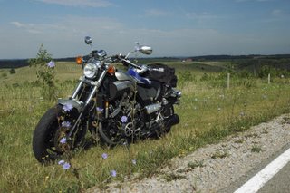
Last Sunday I decided to take a ride after a way too long down time. Upon returning to Arkansas from my wedding in Ohio I've been absorbed in work and getting settled in to the married life. It hasn't been a difficult adjustment thanks to my wonderful bride. She understands my need to ride and always encourages me to get out. We have a lot of great opportunities to travel together on the weekends however and that tends to take up the motorcycle time. I had decided that it was time to get away on the Vmax.
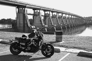
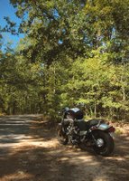
I decided to keep it simple and thought I would ride to Petit Jean State Park about 30 or so miles west of Conway. I headed west on AR 60 and did a short stop at Toad Suck Park on the Arkansas River. I took a few pictures of the bike in front of the dam and continued on. I've travelled AR 60 several times and it never fails to please me. It's a relatively well maintained road with light traffic and eye pleasing farmland. It's sparsely populated which would normally be a blessing but this time my low fuel light came on about seven miles out. I had forgotten to get gas before leaving town. The Vmax isn't exactly stingey when it comes to gas consumption (especially the way I like to ride). In Houston I passed a gas station I thought was closed, which I later found out wasn't, and eventually made my way to Perryville just fine.
Perryville sits on the intersection of AR 60 and AR 9, another scenic route I've been up and down a few times. From Perryville you hop on 9 headed north toward Perry (not to be confused with Perryville) and travel 7 miles to Oppelo where it's a turn west again onto 154/247 toward Petit Jean State Park. The Park is a pretty park with some interesting history, good camping spots and scenic hiking trails. My destination today, however, was just to the top of the mountain and the scenic overlook. Lisa and I had taken this road just a few days back and I new it was going to be a steep twisty trip, I was looking forward to it.
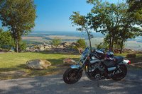
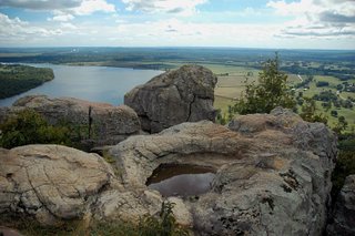
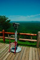
The view from the overlook is magnificent. The Arkansas River runs along side the mountain and cuts through the lush green farmland for as far as you can see. The Park has seen fit to build an elevated walkway around the tip of the mountain but has left several access points for people to climb around on natural rock formations. On the day I was there it was a perfect, cool day and there were several site-seers out enjoying the last days of summer.
The ride was a good one that helped clear out the cobwebs and get me mentally fit for the coming work week. If you are from the Conway area and haven't explored Petit Jean I would recommend checking it out.
Saturday, August 19, 2006
Zanesville, Ohio to McConnelsville, Ohio
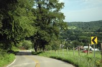
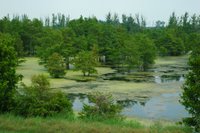
I had the great pleasure to be home for most of July for my wedding. The first two weeks were hectic with future in-laws, parties and a wedding to plan. The days were packed with activity but fun and rewarding. I was glad they were over though. Once the small honeymoon was over my dear new bride was generous enough to insist I go for a ride. I think the screen door was slamming before she got the entire sentence out. Before you know it I was headed down State Route 146 from my hometown of Zanesville south towards Chandlersville. I had planned on taking a circular route down to Cumberland and across SR 83 and 78 to McConnelsville on the Muskingum River. I've always loved that area since I was a boy camping with my parents at the Ohio Power Company campgrounds. There are large coal deposits all over the region and when I was young the area was nothing but a huge strip mining complex. I remember it as a mostly ugly, bleak landscape. The creeks used to run bright orange with the nasty leftovers of the mining operations. Somewhere in the early eighties that all changed and American Electric & Power was forced to do land reclamation. It's been a miraculous make over, with rolling green hills and small lakes scattered everywhere. The area is home to the largest wildlife conservation park in North America, the Wilds. I've never been but will definitely make it there someday soon. I'm not sure if this was planned or just a happy by-product of the engineered landscape but the roads are exceptional, well maintained and nicely curved.
When I got to Chandlersville I decided to take a small road which was actually the northern part of 284, I just picked it up sooner than planned, which turned out to be a good move. The road wound out of the small, sleepy town of Chandlersville up into the hills of south eastern Ohio. My wife, being from Colorado, routinely mocks the hills as too low. They may not be 13,000 feet but the views are still impressive. Traffic was light and the roads were smooth as a billiard table, all in all a blast.
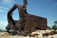
About mid-way through the ride (close to the junction of SR 284 and 78) is the Miner's Memorial. On display is the bucket to Big Muskie, the only remaining part of the world's largest dragline. It was the largest movable landgoing structure with only sea vessels larger. The bucket is HUGE.
78 runs into McConnelsville, a quaint rivertown on the Muskingum River. I stopped to take a few pictures and headed north for the twenty mile trip to Zanesville. Route 60 follows the river and seems to have only gotten nicer over the years. The trees are larger and everything is cleaner than I remember from my youth. The one drawback is that it's a fairly busy two lane with few passing opportunities. I got stuck behind an eighteen wheeler with missing mud flaps and was pelted with rocks for a few miles.
I really gained a healthy appreciation for my own backyard. I hadn't really paid much attention until spending time riding in Arkansas. As many great places as there are to ride in Arkansas it's still over run with litter whenever you get close to people. You can still find the occasional front yard dump in Ohio but they seem to be fewer and in most cases even the poorest looking trailer is neat and tidy with a little flower bed. It seems Ohio has cleaned up considerably since I was a child and it really is a state I'm proud to call home.
Miles - 82
Monday, June 12, 2006
Conway, Arkansas to Arkansas Post National Memorial
I hadn't really planned on riding this past weekend. I was kind of bored and unenthusiastic and had some things to do. So of course what do I do? Hop on the bike and ride 260 miles in 97 degree heat and 90 percent humidity to Arkansas Post National Memorial. Yahoooo!
The first part of the ride (the stretch from Conway to Pine Bluff) was fairly boring. I was headed toward the southeast corner of the state. Arkansas is a wonderful mix of six distinct regions. From the Ozarks to the Delta this state is like three or four states packed in to one. I was headed toward the Delta section. It's a long, flat stretch of farmland from Conway to Gould, Arkansas. The roads are straight for miles and population is sparse. It's a little desolate and in the wrong frame of mind can be a little depressing. Once I started getting into the Delta area I was reminded of my trip to Clarksdale. It's an economically depressed area but there's something authentic about it and like I mentioned in the post of the trip to Clarksdale, I've never been to a place that seemed so right for the music it inspired. This is really blues country.
When I got to Gould I headed northwest on Arkansas 212. It's an interesting road that runs along the top of a levy. It overlooks the backwaters of the Arkansas. This was one twisty road. When the traffic sign says fifteen mph around a corner, the sign ain't lying.
After hitting AR 165 it's a short jaunt across the Arkansas River and to the road into the park. The park itself is relatively small with a rich history. Starting out in 1686 as a French trading post it passed hands through the Spanish and on to the US. It was the first capital of the Arkansas Territory. There's not much left of the town but if you're in the area it's a beautiful park and well worth the trip.
After walking around in the humidity and heat I was feeling a little thirsty. I made a stop at a gas station for a Gatorade where I got into a conversation with a young boy on a West Coast Chopper bicycle. He was waiting for the pool to open. A little curious, I asked if it was the town's public pool. He replied that it was "a private pool that cost $20.00 a year to join, but they don't allow black people in because they trash it." Needless to say I was shocked and disappointed that this kind of thing still goes on. It was an ugly slap to the face and it was a pleasure to get going again.
Still thirsty and now hungry on top of that, I stopped at a Chili's in Pine Bluff. After about fifteen strawberry lemonades and a steak tougher than my riding boots, I was full if not satisfied and back on the road.
As always it was a good ride. It was nice to head to another part of the state I really haven't explored much.
Miles - 260
Monday, May 29, 2006
Ft Smith, Arkansas to Conway, Arkansas
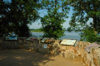
The second day of a two day trip is usually all about getting home to relax. For the second part of my Memorial Day trip I thought I would try something different. I got into Ft Smith on Saturday, got a hotel room early and did a little site seeing. I had a great day and any tension or anxiety I was experiencing from my non-riding life was completely out of my mind. My plan for Sunday was to get over to the Ft Smith National Historic Site early, when no one was around. I had a good night's sleep so I got up at 6:30, showered and headed the few blocks to the park. I walked the paved sidewalk trail that ran along the Arkansas River. The park is small and right downtown. It's okay but a pretty small National Park compared to most I've been to. There's not a lot to it. There is one part of the park that is really touching and sad however. The Trail of Tears overlook has five small signs explaining how many tribes from around the U.S. were herded up and forced into exile in Oklahoma. All of the tribes lost thousands of their people with one group actually losing half of it's member's. It's a pretty shameful story. the thing that stood out to me is to see a picture of the wealthy land owners who had been forced from their homes in Georgia. It just brought home the fact that these were productive, intergrated citizens that lost everything. It was not our greatest moment as a nation.
By the time I had done a walk around the park clouds were gathering to the west and I decided it was time to check out and get back to Conway. I picked SR 64 for the return trip. It runs parallel to I-40 but twists both north and south. It looked pretty fun on a map. It turned out to be fun on the 1:1 version as well. The great thing about the road was it went through enough small towns to keep things interesting but still covered a lot of secluded back country. Traffic was typically light, I guess as 64 runs along I-40 most people opt to take the boring route.
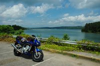
Maybe the best aspect of this ride was the fact that I came out in Russellville, where I usually head south. I got to see the park around Lake Dardanelle for the first time. It was such a nice area I turned around to stop and get some pictures of the bike. The return trip, instead of being a race back, was actually as enjoyable as the first leg the day before.
Second Day Mileage - 136
Sunday, May 28, 2006
Conway, Arkansas to Ft Smith, Arkansas
For this ride I decided to visit Ft Smith over the Memorial Day weekend. I thought I would follow a route I've been across a few times before. I started out on SR 64. Making my way to Russellville was familiar but not boring. The small towns between Conway and Russellville are quaint and the scenery is always outstanding. Riding is always relaxing to me once out of town. Conway is really full of the worst drivers I've ever encountered. Once out of the city limits that all changes.
Once in Russellville I took a left at AR 7 and headed south to Dardanelle where you hang a right on AR 22 and proceed west again. Like most roads in this part of the state, there isn't a lot around. Very small towns like Liberty and Carbon City are spread out frequently but you don't see a lot of traffic. I was surprised at the lack of holiday travel. 22 passes by several recreational areas and there weren't the lines of slow moving R.V.s I had anticipated seeing.
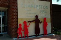
I passed by the Subiaco Abbey again and stopped for lunch at the Grapevine Restaurant in Paris. I've eaten there a few times and it never fails to please. The staff is super friendly, the menu varied and the food delicious. Once through Paris I hit uncharted territory as I had turned south for Mt Magazine on the previous trips. This portion of route 22 looked pretty similar to the first part which is to say a great ride. There was an interesting stop in Charleston I made. The story of Charleston National Commemorative Site is a pretty good one especially after Lisa and I visited Little Rock Central High School a few weeks ago. Where the Little Rock School Board rejected the ruling of the Supreme Court in Brown vs. the Board of Education, Charleston on the other hand voted almost immediately to integrate. It was apparently a great success and used as a model for several surrounding communities. Not enough followed their example though.
Finding the Ft Smith National Historic Site was easy enough. Route 22 went right into the downtown area and past the park. Like most traffic signs in Arkansas, the familiar brown and white national parks signs are just far enough apart to make you wonder if you missed your turn. I'm use to more frequent signs and this has been a complaint of mine since I got to Arkansas. As I needed a bottle of water (the temperature was 92!) I stopped at a gas station and asked the clerk for directions. I'm not too proud to ask despite what my fiancé says. I drove through the main street of Ft Smith, the town, which looked like so many other towns across the US. It was a mix of closed department stores, bars, lawyer offices and banks. I had merged onto SR 64 again and was headed toward the Arkansas River. After checking the hours of the park I decided to find a hotel. There are a few clean looking places to stay and I lucked out, finding a room at the Howard Johnson's. A rodeo was in town and rooms were going fast.
After resting up and cooling down I decided to ride into Oklahoma to see what it looks like in this area. I have spent some time in other areas of Oklahoma and know from experience it's a pretty state with several different terrain types depending on what part you're in. Everything in this part of the country is bursting green at this time of the year. With as little rainfall as the area seems to get, I imagine in a few months it will all be brown. For now it was beautiful. I passed a small local motocross race track the was buzzing with activity. I rode back to Ft Smith, had a bland dinner at the hotel restaurant and headed back to the track. It was a regional race with the winner moving on to the national finals, although I'm not sure for what organization. I'll post an article about this race in a few days.
I was dead tire by about 8:30 so I decided to skip the final races and head back to the hotel. I checked out the 1/2 price beer offer in the bar and watched a local cover band play. The half price Fat Tire was good, the band wasn't. By the second beer I was ready for bed. My head hit the pillow and I was out. It had been a great day with some satisfying riding and a few fun diversions, and I hadn't even been to the park yet. I've decided to break this trip up into two posts, so I'll cover the return trip in the next installment.
1st day miles - 140
Saturday, May 20, 2006
Conway, Arkansas to Hot Springs, Arkansas
I left for a ride yesterday morning headed to Perryville, Arkansas. There was a motorcycle festival at the Perry County Fairgrounds. I'm not really into mass gatherings like that. I don't have any desire to go to Sturgis or Daytona Bike week but I've never been to one of these events so I thought I would check it out. I left around 9:00 o'clock headed west on Arkansas route 60 toward Toad Suck Park. The park occupies both banks of the Arkansas river and on this Saturday it was filled with campers, picnic'ers and fishermen. AR 60 is another fun Arkansas road. I haven't met a bad road in this state yet. Traffic was light and the going was just slightly faster than the speed limit of 55 with no problems. The problems only started once I got to Perryville. The dozens of motorcycles cruising past the town hall square told me I was in the right place. I parked in the public library lot and walked around for a bit. It was in the low nineties and sunny so I began sweating profusely. I walked around, checked out the custom car show, paid way too much for a lemonade and headed towards the fairgrounds. I paid five dollars for the entry fee, walked around some of the vendor's booths searching for a hat to protect my bald head from the sun. I didn't have much to choose from and decided to risk it without one. Big mistake. I walked around for a total of ten minutes and decided to head back to the air-conditioned hotel. I was feeling pretty ill.
Today I got up with an unsatisfied desire to ride. I decided to leave the camera at home and just ride. It was slightly cooler this morning. The roads around Perryville looked interesting so I decided to retrace my route. Once into Perryville I headed down AR 9 south toward Hot Springs. What a beautiful road! This part of Arkansas is sparsely populated with well maintained roads. The route cuts through the Ouachita National Forest which is full of pine trees and gorgeous scenery to spare.
I hit AR 5 and followed it west into Hot Springs. I've been to Hot Springs before, it's a beautiful old town with an interesting history and several historic buildings, several of the old bath houses are now part of Hot Springs National Park. It's a great down town to walk around and spend a day. But not today, I was having too good a time riding. I did a pass through downtown and tried to find SR 70 out of town. One thing I've noticed about Arkansas is the lack of traffic signs. I'm pretty good at finding my way around but on more than one trip I've had to do some searching for the right road. The rest of the trip was uneventful. SR 70 is a three lane highway, with the passing lane alternating between sides. The traffic was exceeding the speed limit and the side roads just dump right on to the highway. It's a frantic road with cars making left hand turns frequently, with little notice. The rest of the trip up I-30, I-430 and I-40 were pretty much the same.
This ride was so much better than Saturday's. I did something I haven't done in awhile, left the tank bag, and camera behind. I didn't have a destination picked and it turned out to be the best ride I've had in a long time.
Miles - 161
Monday, May 15, 2006
Radial Engined Bike
From The Kneeslider.com:
The rest of the story is here.
The radial engine is a thing of beauty and it looks like several other folks think the same thing. After we posted the radial motorcycle yesterday, we contacted Rotec Engineering, makers of these 7 cylinder radial engines, and according to them, there are at least 4 of these projects in various stages of completion at the present time.
The rest of the story is here.
Saturday, May 13, 2006
Conway, Arkansas to Buffalo National River, Arkansas
Today's ride was probably the best in Arkansas yet. My lovely fiancé, Lisa visited last weekend so I didn't get a chance to ride. We did get to do some traveling. We went to Memphis and visited Graceland, which was a lot of fun. I was itching to ride all week though. The weather forecasts were all looking good for the weekend and I was so excited to ride I almost couldn't get to sleep soon enough. Some where in the early morning I heard thunder and lightning outside. I drifted off thinking the ride was a lost cause. I woke up again around 6:30 and checked the Weather Channel and local news to see that the rain was moving out. By the time I got dressed and ready the roads were semi-dry. I took my rainsuit just in case.
I had to hit the Village Inn on my way out of town. After the breakfast stop I headed north on SR 65 at 9:30 am. This is the same road I followed to get to the Natural Bridge so there weren't any surprises for the first 40 miles or so. That quickly changed after I passed the turn off to the Natural Bridge and hit uncharted territory. It's not just that the SR 65 became new to me but the road and terrain became an almost perfect motorcycle road. I very rarely speed but this sweeping, swooping road begged for it. For about twenty miles it was just me headed north. Everyone else was going the opposite direction. The blacktop was smooth for the most part, some sections were grooved but nothing unruly at moderate speeds. There were no towns to slow my progress (for most of the time anyway) so it was just one hill to climb after another. The curves were nice long high speed sweepers with subtle but effective banking. The scenery was perfect for the slightly more than legal speeds I was doing too. There were plentiful trees with nothing to distract me from the task of riding. It was definitely pretty but didn't offer a lot that you couldn't appreciate with more than just your peripheral vision. Somewhere around Grinder's Ferry I saw a few canoe rental companies loading up old school busses of tourists. The congestion caused me to slow down, which allowed me to see the sign for Buffalo National River. Lisa and I have National Park Passports and I'm always on the lookout for a place to get a stamp. I stopped at the vistor center, got my book stamped and as an added bonus the woman at the desk gave me a better route to take than what I had originally planned.
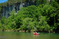
I stopped in the park to get some pictures. There were a lot of kids and adults getting ready to raft down the river. It looked like everyone was having a great time.
I got back on SR 65 and headed for Bellefonte where I jumped on to Arkansas 206, a nice two lane country road. I didn't go all the way to Harrison Arkansas as I had originally intended because the road the clerk at the visitor center suggested looked a lot more twisty. It was too, with a couple ninety degree turns. I hadn't rode a stretch like that since California. It was a fast 8 miles to Arkansas 7, the scenic byway. This road lived up to the title. It was as good as SR 65 with the one drawback of traffic. This road unlike 65 was two lanes with few passing opportunities. Once again I found myself riding a little faster than usual until I would catch up with a line of site-seers. Everyone was keeping the speed up though so it wasn't a big problem.
I passed an old theme park in the middle of nowhere called "Dogpatch" judging from the design of the buildings it was apparently based on the Lil Abner comic strip. I guess not enough people follow Lil Abner anymore to support the park. It's a shame it was gated and locked up as it looked pretty interesting. I made a stop at a Conoco station in Jasper for a slice of pizza and a Mountain Dew and a few more pictures before heading on. I was getting a little stiff by this time, I had reached the point in the ride when I was looking toward home. Scenic 7 kept my interest for the next 76 miles though. I was headed to I-40 at Russellville for the 40 mile dash back to Conway. 7 was filled with motorcycles headed in both directions. It was a perfect day weatherwise and it was great to see everyone taking advantage of it. There were mostly Harleys, metric cruisers and Goldwings. As fun as AR 7 was I was surprised to see only two sport bikes (an R1 and CBR1000 riding together).
The ride on I-40 was the usual interstate experience, crowded and hectic. Thankfully the 40 miles went fast and I got back to the hotel at 4:30 pm, feeling satisfied and relaxed as I usually do after a great ride like this.
Miles - 248
Sunday, April 30, 2006
Conway, Arkansas to Little Rock, Arkansas
I just took a small Sunday drive today from Conway across SR 64 into Beebee and down SR 67 to Little Rock. It was a pleasant ride through the farmlands. I left around 10:00 o'clock this morning so the traffic was pretty light. Things don't get hopping until noon or so, as most of the cars are in church parking lots until then. As I got into North Little Rock there was quite a bit of construction on 67 and the traffic picked up considerably so it was hairy going for awhile. Once I made the quick hop on SR 67/I-40 to I-30 south into downtown everything calmed down again. The city seems nice and clean. It's a smaller city but pretty. It's laid out on two sides of the Arkansas River. There's a revitialized riverfront developement with shops, resturaunts and a park (complete with a pavilion for live performances). Of course all of this was closed while I was there.
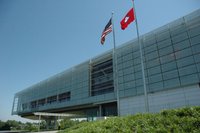
After getting off the bike and walking around the park for awhile I decided to head over to the William J Clinton Presidential Library. It's a pleasant looking building from the highway so I thought I'd get an upclose look. I wasn't in the mood to walk around inside so I thought I would save that for another trip. I did get some nice pictures of the outside. Like everything else around here, Sunday morning seems to be a good time to go. The library was open but there were no long lines or crowds to fight. I made one last pass through town and the auto and pedestrian traffic was beginning to pick up. I headed back up SR 67 to 64 and hightailed it home.
The day was sunny and mild. I think the high was 74 degrees. After yesterday's deluge I was happy to get out on the road for a bit.
Miles - 132
Saturday, April 22, 2006
Conway, Arkansas to Mt Magazine State Park, Arkansas
I took off this morning at 9:30 or so headed for Magazine Mountain. At 2753 feet it's the highest point in Arkansas and it's only 84 miles from Conway. I have a semi-tradition of trying to make it to the highest point in whatever state I happen to be in. I don't always make it but I have been to the upper most reaches of New Jersey, Alabama, Colorado and now Arkansas. I should clarify, I'm talking the highest paved point. I'll leaving the hiking to Lisa.
I pulled out of the hotel and jumped on I-40 headed west just to the next exit. I got off and took off across State Route 64 which parallels the interstate so close it keeps popping in and out of view. 64 was still better than I-40 though. It's a well maintained road. It's pretty straight for the most part, but there are curves and hills enough to keep it fun. Traffic was light and there was ample passing room for the occasional calico pick-up with the crooked bumper. The road cut through several small towns. They were a lot like small towns everywhere with empty shops and boarded up gas stations. The road also seemed to be road kill central. If you weren't seeing a carcass you were smelling one. It was an olfactory overload.
On SR 64 I went through Morrilton and on into Russellville. I wasn't sure where I was heading. I was using a bad photo copy of a bad map I had stuffed in my tank bag and the roads were hard to see. I saw a little auto show in a store parking lot and decided to seek directions and check out the cars. There were some pretty nice hot rods and motorcycles on display. There was a brand new Ford GT which seemed out of place in the middle of rural Arkansas. The owner (or the owner's son) was rubbing the paint to within an inch of it's life.
After getting directions from a security guard I was on my way again. For about ten minutes. I wanted to be on Arkansas Route 27, which I was for those brief ten minutes, but I ended up going west again on AR 22. It all worked out as it went around in a big loop anyway. The whole Magazine Mountain area is a part of the Ozarks National Park and a recreational area for boating, hunting, camping, fishing, hiking and you get the idea. All roads (as few as there are) lead to Magazine Mountain. If I hadn't got lost I might have missed the Subiaco Abbey. I came out of the woods and turned the corner and there was a huge-castle like building even more out of place than the GT. It seems that in 1878 some Benedictine Monks founded the Abbey and now it's an Academy.
I came into Paris AR. hungry and ready for a break. I stopped at a tiny little place called the Grapevine, where I had one of their creations called the Santa Fe. It was a delicious salad with black olives, corn, tortilla strips, chicken and the house avocado ranch dressing. I'm not usually a salad eater but it was really satisfying.
Once I was finished I went one block and turned south on AR 309 which turned into the Mt Magazine Scenic Byway. It lived up to the name too. You start to climb up the mountain into the trees. The road at this point is under some major construction. It looks like it is being widened and the curves smoothed out. It'll be nice when it's done but for now it's a mess and a hazard. Fortunately that doesn't last long and the road turns into a decently wide two lane. The fun really started here. There were some tight twists and switchbacks along with some high speed sweepers and traffic was light. There were a few campers but like 64 there are several good passing areas. And for some reason people seem to freeze up in fear when a motorcycle pulls up behind them on a twisty mountain road. I had to slow down for fear of driving some guy off the road. He was going way too fast in an effort to keep ahead of me. He finally pulled over to let me pass.
Somewhere along the way I started back down. If the highest spot on the road was marked I missed it. As fun as the road was, I wasn't too upset and probably wouldn't have wanted to stop anyway. On the way back I looped around to AR 27 and found the route back to Dardanelle, where I had originally went awry. I was getting tired and thirsty by this time so I headed toward I-40 for the quick trip back. It was interesting to see how different the land was compared to the back roads, even though I rode most of the way right along the highway for the first half of the trip. The freeway seemed a lot more desolate and the terrain along it was swampy. Way too much traffic too.
It was a great ride. It reminded me of so many other places I've been but it was also distinctly Arkansas. Very sparsely populated and green. It was a good side to the state that I haven't seen too frequently since I've been here. The state has moved up a notch with me (the western side anyway).
Miles - 201
Sunday, April 16, 2006
Conway, Arkansas to Clarksdale, Mississippi
I left yesterday at around nine o'clock in the morning for Clarksdale Mississippi. I was headed for the spot where US 49 and US 61 intersect, known in the world of Blues music as the crossroads. It's on that spot where the legend of Robert Johnson is rumored to have started. Robert lived in obscurity until he supposedly signed a deal with the Devil in Clarksdale one night (and I guess he still is pretty obscure to most people). I was very excited to see what I felt would surely be a creepy, swampy and lonely stretch of road. I headed east on I-40 from the hotel I'm currently staying in toward Little Rock. The weather was calling for record highs for Easter weekend. It was in the mid-seventies already at nine. There were some high scattered clouds but it was otherwise perfect. I stayed to the interstate for the first 90 miles to exit 216. I got off at Brinkley Arkansas and headed down US 49, thrilled to already be on one of the roads that was my goal. Glad to be off the interstate, I took off to Helena Arkansas, on the Mississippi river. The road cuts through farmland and reminds me a great deal of northern Ohio around the Toledo and Findlay area, just a lot less people. I got to the Helena Bridge and stopped to stretch and get a picture of the bridge. Unfortunately there wasn't a good place to pull over close enough to see the river itself. I passed several motorcycles going both ways. Like I said it was a perfect riding day.
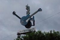
The rest of the 177 miles was pretty uneventful. It was a flat straight shot to the first intersecting of 61 and 49. It turns out the two merge for several miles before you hit the crossroads. The anticipation was building although I was noticing the four lane highway 61 & 49 had become. I simultaneously saw the sign for 49 east and 61 south and the big cloverleaf off ramps. So much for a dirt road with trees covered in Spanish moss and owls staring at me. I got off and headed toward town. At the intersection of State road 161 and US 49 was a sign with three guitars proclaiming I had found the crossroads.
I had no plan other than riding to Clarksdale and Rosedale and seeing what happened when I got there. I tend to not plan my trips out very well preferring to use the destination as more of a reason for the ride. When I got to Clarksdale I saw signs for the Delta Blues Museum so I headed downtown. This part of Mississippi is beautiful and the people are friendly but it's a dirt poor part of the country. The downtown area was dead on a Saturday afternoon. There were some attempts at economic stimulation. The museum itself seemed to be the centerpiece for this renewal. It was in a remodeled train station with some shops in matching buildings a little down the street. For as quiet as the town was I was surprised to see several people touring the museum. The Delta Blues Museum was nice, clean and the guy at the front desk was helpful and friendly. Some of the displays were the "muddywood" guitar designed by Billy Gibbons of ZZ Top fame. It was created from a chunk of Muddy Waters childhood home torn free from a tornado. Built for fund raising to pay for the museum in 1988 it goes on tour from time to time but is usually on display in the Muddy Waters cabin inside the museum. There were several guitars and old instruments on display. There were several Stella guitars there. These were apparently the guitar of choice for the blues artists of the 20's and 30's. I have to make a disclaimer here. My knowledge of the blues derives almost entirely from artists like Stevie Ray Vaughn, ZZ Top, and Led Zepplin. I have a few John Lee Hooker albums and know some of the more well known names. I like the music however and the museum instilled me with an interest to check some of the artists out.
There were two photography exhibits. One was a great series by a woman named Panny Flautt Mayfield. They are taken in Juke joints in the area. My favorite has to be a more recent photo of Robert Plant dancing in one of the blues clubs. His face is covered in a scruffy beard, head down holding a bottle of Budweiser. His arms are held up in front of him and he looks like he's in a trance. Behind him is a heavyset African American woman staring at the camera looking happy and content. The caption reads, "Robert Plant enjoys the anonymity of the Red Top Lounge". It's instantly become one of my favorite photographs.
That afternoon I headed down Highway 1 to Rosedale (40 or so miles from Clarksdale) with Eric Clapton's song Crossroads running through my head alternating with Led Zepplin's Traveling Riverside Blues. Highway 1 runs along the river and I thought maybe this was the route Robert Johnson took when he wrote the original song. The town was clean and quaint and the people were friendly. An old gentleman honked at me when I first got in to town. Thinking I had pulled out in front of him or something to that effect I turned and he waved. It seems that everyone honks and waves to everyone else. I liked it.
I got home at around seven with the idea of going to a local blues bar and seeing some live music. I think that would have been a perfect event to end this post on. Unfortunately riding all day in the heat took it's toll and I fell asleep, waking up just long enough to get undressed and into bed. The next day I got up early and left under cloudy threatening skies. The wind hit me broadside all the way back to Conway.
All in all it was a pretty good ride. The roads were pretty much straight and dull, the scenery was not bad, not great but the big draw of it all was treading the ground that so many legendary musicians had walked on and seeing the place were the Delta blues was born. I don't think I've ever been where the music fit the place so appropriately.
Miles - 455
Saturday, April 1, 2006
Conway Arkansas to Clinton Arkansas
Well, I was able to take my first real ride of the season finally. I'm working in Conway Arkansas right now. One of my co-workers took a ride last weekend toward the Natural Bridge and said Arkansas 65 was a nice road. I took off at around ten o'clock. The Weather Channel was calling for rain so I grabbed the rain suit and headed out. It was heavily overcast but the clouds were those high kind that usually mean no rain (right away anyhow) and it was about 72 degrees. I jumped on I-40 briefly and headed off exit 129 northbound on Rte 65. The road was in pretty good condition. Traffic wasn't bad, it was light and most people were watching their speed. After about five miles I saw why. There were three State Troopers in the next five miles. All told I would see about eight Troopers on the trip. The only thing I saw more of were churches and antique stores. I've literally never seen so many churches in a 40 mile strip of road. The road went through several small towns and the area seemed a lot like the places in Alabama I've rode before. The litter was less than around Conway which was nice.
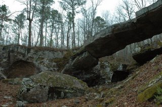
The Natural Bridge park is about three miles north of Clinton. The road into the bridge is narrow, barely one lane but it's only a mile or so and there doesn't seem to be much traffic. There's a small gift shop and a very short nature trail and "hill billy" display including a still. It cost $4.00 to get in to see the bridge. The gift shop is strategically placed to block the view which works out for the proprietors because if you could see it from anywhere coming in it would only take a glimpse to see it all. It was more of a reason to ride somewhere. The woman in the gift shop was nice and helpful. When I mentioned the twisty and steep nature of the road she mentioned the park is closed from the end of November until the first of March.
By the time I got to Clinton the sun was out and it was gorgeous. The trip back was uneventful. I was looking forward to stopping for lunch at the Mexican restaurant I passed on the way up. It was as good as I had hoped. It was so nice after lunch I decided to ride to Little Rock. Little Rock is thirty miles southeast and by the time I got to Little Rock the sky to the south was so dark you couldn't see the skyline of the city. I decided to hightail it home. All in all it was a great ride, but than there's ever hardly a bad one.
Miles - 144
Wednesday, March 29, 2006
Fresh Start
I've decided to start another blog. I've been wanting to seperate my goofy political rantings from the good stuff. I'm going to continue posting on Life's Been Good... but this site will be for motorcycle rides I've taken or any other bike related stuff. As a result there will be fewer posts but I'm hoping to make them a little higher quality. On LBGTMSF I go for emotion so I write fast and do minimal editing.
Springs coming, It's suppose to be sunny and in the seventies this weekend so we'll see. I hope to be posting soon.
Subscribe to:
Posts (Atom)